WAFEFAL
Animation events
Original English and German reports. Highlighted notes identify documented differences in meaning or missing text; unmarked reports have not necessarily been verified as equivalent. About differences between the texts.
Choose an event to play its report here.
Mixing effects is a browser-only aid; it differs from the captured game.
Turn 0 · after 1 actions
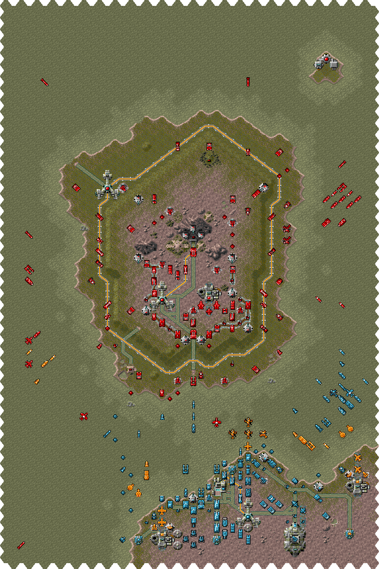
Satellite communication: Strategist, the speed of your advan- ce has been impressive. Only the small island of Wratulon is still in enemy hands. Titan-Net's hiding place must be lo- cated there. The increased troop movements and strengthened posi- tions spell out an unambiguous message. Our allies among the rebel troops under Benuntai Gerr will provide air support. Your task is also to lead the land and sea forces. Objective: - Find entrance to Titan-Net's hiding place and occupy it
Satellitenverbindung: Stratege, die Geschwindigkeit Ihres Vormarsches war beeindruckend. Lediglich die kleine Insel Wratulon ist noch in der Hand des Gegners. Das Versteck Titan-Nets muss dort sein. Verstärkte Truppenbewegun- gen und der Ausbau von Stellungen sprechen eine eindeutige Sprache. Unsere Verbündeten der Rebellen- truppe unter Benuntai Gerr sorgen für die Luftunterstützung. Ihre Auf- gabe ist die Führung der Land- und Seestreitkräfte. Auftrag: - Eingang zu Titan-Nets Versteck finden und besetzen
Turn 3 · after 3 actions
Satellite communication: Reconnaissance have brought back interesting photographs of a high mountain in the middle of the island. Curiously, strong enemy units are guarding the entrance to a cave system there. Perhaps the end to all our suffering lies within.
Satellitenverbindung: Aufklärer überbrachten merkwür- dige Aufnahmen von einem hohen Berg im Mittelpunkt der Insel. Seltsamerweise bewachen starke Feindverbände den Eingang zu einem Höhlensystem. Vielleicht liegt hier das Ziel unseres Leidensweges.
Turn 6 · after 4 actions
Satellite communication: Strategist! Our information indicates tactical weaknesses in the enemy's northern defensive ring. Further reports mention the proba- bility of a series of bases occupied by the dreaded fighting drones. A tiny island has been sighted to the Northeast. It hides a research labo- ratory which produces a conside- rable amount of energy. Please undertake the necessary steps.
Satellitenverbindung: Stratege! Unsere Informationen weisen auf eine taktische Schwäche im nördlichen Verteidigungsgürtel des Feindes hin. Weitere Berichte sprechen von einer vermuteten Reihe von Stützpunkten der gefürchteten Jagddrohnen. Im Nordosten wurde eine winzige Insel gesichtet, die ein Forschungs- labor birgt, welches sehr viel Energie produziert. Leiten Sie die notwendigen Schritte ein.
Turn 0 · after 3 actions
Meteorological Section: After a move to more settled condi- tions an extensive area of high pressure will reach the area. Clear air with good visibility.
Meteorologische Sektion: Nach kurzer Wetterberuhigung zieht ein stark ausgeprägtes Hoch in das Vorhersagegebiet. Die klare Luft bietet gute Weitsicht.
Turn 6 · after 1 actions
Meteorological Section: Moderately increasing winds and light snow flurries will reach the area in a few hours.
Meteorologische Sektion: Mässig auflebender Wind und leichte Schneefälle erreichen in wenigen Stunden das Vorhersagegebiet.
Turn 7 · after 1 actions
Meteorological Section: Heavy cloud today and tomorrow. Fresh snowfall can be expected in low lying areas.
Meteorologische Sektion: Heute und morgen ist stark wolkiges Wetter zu erwarten. Im Flachland ist mit Neuschnee zu rechnen.
Turn 10 · after 3 actions
Meteorological Section: After a move to more settled condi- tions an extensive area of high pressure will reach the area. Clear air with good visibility.
Meteorologische Sektion: Nach kurzer Wetterberuhigung zieht ein stark ausgeprägtes Hoch in das Vorhersagegebiet. Die klare Luft bietet gute Weitsicht.
What's inside — 3 of 16 buildings, 5 loaded transports
- DRONE FACTORY26, 13
 THUNDER FXTHUNDER FXEXTERMINATORSTORMBRINGER
- WRATULOW AIRPORT26, 25GENOM J1
- WRATULON AZ.28, 41TROLL I42
Carried by units standing on the map